

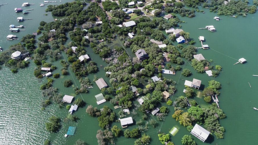
Flood risk around a lake is measured from elevation, mapped water levels, terrain, and drainage rather than distance from the shoreline alone. Buyers comparing waterfront homes for sale may find neighboring parcels in different flood zones because elevation changes can alter exposure. Understanding how those classifications are created helps buyers read flood information more accurately before considering a purchase.
FEMA Flood Maps Used to Classify Lakefront Property Risk
FEMA publishes Flood Insurance Rate Maps that identify areas with different levels of flood risk. These maps divide land into zones based on studies, historical information, terrain, hydrology, and modeled flooding, giving lenders, insurers, communities, and property owners a common reference.
Searches for lake homes for sale near me should include a check of the current map panel for the exact parcel rather than the neighborhood. Boundaries can cross individual lots, meaning part of a lakefront property may lie within a mapped floodplain while the house itself sits on higher ground.
Base Flood Elevations That Define Flood Zone Boundaries
Base Flood Elevation, often shortened to BFE, represents the modeled height floodwater is expected to reach during a flood with a one-percent annual chance of occurring. Engineers compare this elevation with surrounding land and structures to understand which areas fall below or above that level.
Properties advertised among lake houses near me may therefore have similar shoreline frontage but different flood exposure. Finished-floor height, foundation type, mechanical equipment placement, and lowest adjacent grade can all become important once a property’s elevation is compared with the BFE.
Shoreline Elevation Compared With Expected Flood Levels
Ground elevation rises and falls across waterfront land, sometimes within a short distance. A low shoreline can experience periodic inundation while a home positioned farther uphill remains above mapped flood elevations.
Purchasers reviewing waterfront property for sale should study the vertical relationship between the water, yard, driveway, foundation, and outdoor structures. Steep banks are not automatically safer, since drainage channels or low pockets elsewhere on the parcel may still collect water.
Topographic Surveys Used to Verify Lakefront Flood Exposure
Topographic surveys document changes in ground height across a site using measured elevation points and contour lines. Surveyors can show slopes, depressions, drainage routes, retaining features, buildings, and shoreline conditions that broad flood maps may not display in detail.
Anyone comparing lake front homes for sale can use this information to see whether additions, garages, patios, or other improvements occupy lower portions of a lot. Accurate terrain data may also help engineers evaluate grading or drainage improvements before construction begins.
Floodplain Models That Account for Water Level Changes
Hydraulic studies use hydrologic models to estimate how water may spread under storm and flow conditions. Calculations can incorporate rainfall, watershed runoff, channel capacity, reservoir behavior, terrain, and other factors that influence expected flood levels.
Owners considering a lake house for sale should remember that normal lake level and mapped flood level are not the same measurement. Calm water seen during a property tour does not show how far water could extend under the conditions used for floodplain modeling.
Local Drainage Patterns That Influence Flood Zone Placement
Rainfall does not need to come directly from the lake to create problems on waterfront land. Runoff traveling downhill from roads, neighboring parcels, roofs, and paved surfaces can follow natural swales toward lower parts of a property.
Visible clues such as sediment deposits, washed mulch, standing water, culvert outlets, or eroded channels deserve attention when inspecting waterfront property for sale near me. Local drainage can affect practical flood exposure even where a structure sits outside a mapped high-risk zone.
Survey Elevation Data Used to Confirm a Property’s Flood Zone
Elevation documentation can establish the measured heights of a building, nearby ground, and other reference points relative to the flood information used for the site. Licensed surveyors collect field measurements that may support insurance reviews, building decisions, floodplain administration, or requests for further map evaluation.
Records should be compared with the flood map, deed, site plan, and any available elevation documentation instead of relying only on an online listing. Prospective owners evaluating waterfront homes can also ask local floodplain officials, surveyors, insurers, and lenders how a specific classification affects construction and coverage requirements.
Duckett Pointe offers a secure sanctuary where homeowners can enjoy panoramic water views without the constant worry of flood risks. Whether you choose one of their luxury maintenance-free townhomes or custom lakeside estates, investing at Duckett Pointe means securing the ultimate peace of mind. You can leave the stress of property protection to their full-service concierge and focus entirely on enjoying a seamless, protected legacy on the water.
